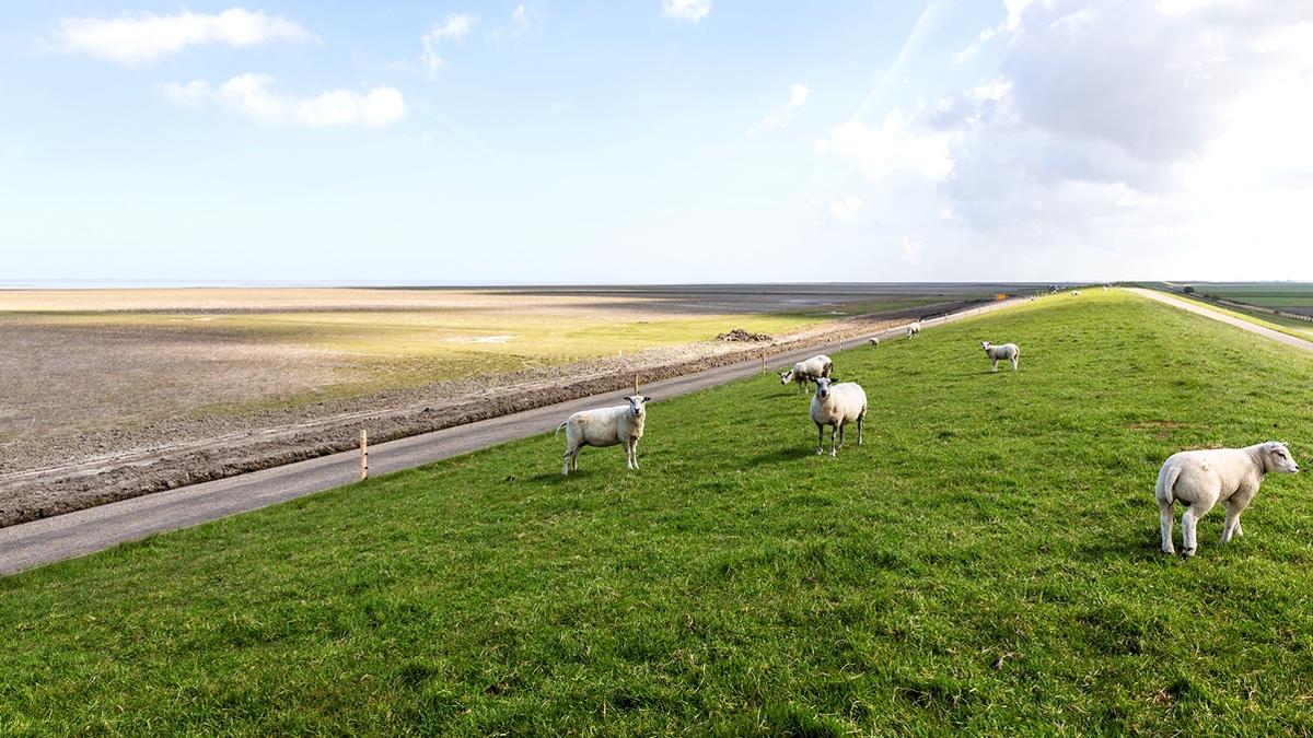
Photo: Wetterskip Fryslan. Dike system.
Coastal risk management
R. Zijlstra, J.L.A. Hofstede, T. Piontkowitz, F. Thorenz
PDF1. Introduction
People have lived along the coasts of the Wadden Sea and on the Wadden Islands for a long time. The sea has always threatened inhabitants and their assets, by flooding and coastal erosion. First, people managed to survive by living on higher grounds and by building artificial dwelling mounds that were high enough to prevent flooding during high water (see Figure 1). Later, dikes and coastal protection works (like groins) were built to protect the hinterland from flooding and to stop coastal erosion. Over time, people gained knowledge and improved dike building techniques and built more and stronger dikes. Nowadays also sand nourishments take place to prevent coastal erosion. About 3.5 million inhabitants live in the Wadden Sea region and are dependent on effective and reliable coastal risk management (CPSL, 2010).
Figure 1. Artificial dwelling mound (Photo: Robert Zijlstra).
Coastal risk management aims to safeguard coastal areas, their inhabitants and economic assets from flooding during storm surges and loss of land due to erosion. Coastal risk management consists of different elements (see Figure 2A) that together provide safety. Along the Wadden Sea coastline the basis of coastal risk management is formed by man-made coastal flood defences and coastal protection works (such as dikes, dams and revetments) and the natural dunes on the North Sea side of the Wadden Sea Islands. These together form coastal protection. Coastal risk management further consists of sustainable spatial planning in the hinterland (prevention), preparing the society for an eventual disaster (preparedness), organizing emergency response and the recovery from flooding events (recovery). In the Netherlands the principle of multilayer safety was introduced in the first National Water Plan (2008) and used in the Delta Programme to distinguish the different aspects or coastal risk management (see Figure 2B).
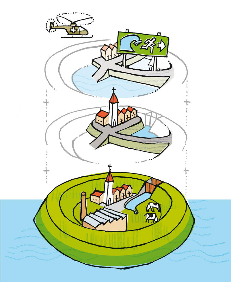 Figures 2. Left (A): Coastal risk management cycle (Image: Hofstede, 2007). Right (B): Multilayer safety: protection, prevention and preparedness/ emergency response (Image: Dutch National Water Plan, 2008).
Along the coastline of the Wadden Sea a large length of dikes is present to protect the hinterland from flooding. Further, in the Netherlands and Germany, sand nourishment is conducted on the coast of the Wadden Islands to combat coastal retreat. On some island locations, additional hard construction works are necessary to combat structural erosion. To protect salt marshes from coastal erosion management techniques such as (brushwood) groin fields are used. Figure 3 shows the present coastal flood defences and coastal protection works, excluding salt marsh protection.
This report describes the present status of, and trends in, coastal risk management around the Wadden Sea. It addresses relevant developments in coastal risk management since the previous Quality Status Report (2009). It is noted that in previous QSRs this report was named Coastal Defence. Subsequently the following status and trends are treated: flood defences and coastal protection works, climate change and long term strategies, integrated and more natural solutions and finally spatial planning and the EU Floods Directive.
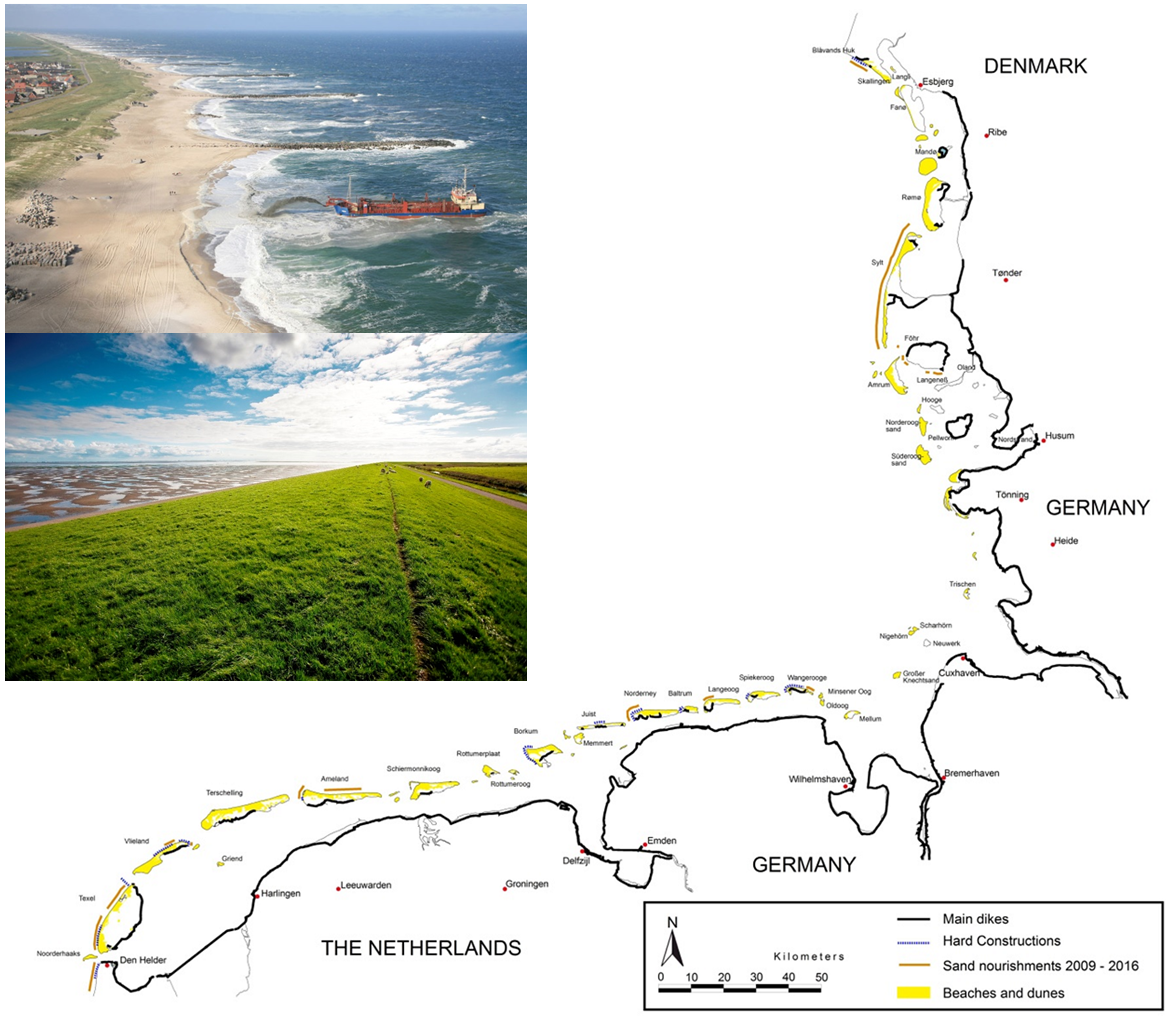 Figure 3. Coastal flood defences and coastal protection works (map: CWSS). Photos: Upper left: groins / hard construction and sand nourishment in Denmark (Photo: Hunderup Luftfoto/ DKI); Lower left: typical ‘green’ Wadden Sea dike (Photos: Wetterskip Fryslân).
2. Status and trends
Coastal flood defences and coastal protection works
In the Netherlands several smaller dike stretches along the Wadden Sea were strengthened between the years 2009 – 2015. The safety of all dikes was checked in 2009: around 100 kilometres of the in total about 200 kilometres of dike (excluding islands and Afsluitdijk) along the Wadden Sea and Ems estuary need further improvement. Many works will start in the coming years (2016-2021) (see www.hoogwaterbeschermingsprogramma.nl). Large projects are the improvement of the dike between Eemshaven and Delfzijl, the Lauwersmeerdijk and some of the dikes along the coast of the province of Fryslân. On the islands of Ameland and Texel improvement works started in 2016 for 16 and 17 kilometres-long dike sections respectively (see www.kijkopdedijkameland.nl and www.hhnk.nl/waddenzeedijk).
To prevent structural erosion of the islands, sand nourishment was conducted on the beach or in front of the coast of the islands (see: www.rws.nl). Between 2009 and 2015 sand nourishment comprised of almost 21 million m3 was conducted on the Dutch Wadden Sea islands. Roughly half of this amount supplied the beaches, the remaining part on the shore face. The island of Ameland was nourished the most, almost half of the sand volume. Further nourishments were executed on the islands of Vlieland and Texel. Schiermonnikoog and Terschelling did not require any measures. Just outside the Wadden Sea area, along the coast of North-Holland, a large amount of sand nourishment (35 million m3) was carried out in 2014 and 2015 to strengthen the Hondsbossche and Pettemer Zeewering. It is expected that sediments will erode here and slowly move into the Wadden Sea and along the coastline of Texel. New hard construction works are only applied when solutions with sand have proven to be ineffective.
In Lower Saxony, the Master Plans Coastal Risk Management Niedersachsen for the mainland coast and the East Frisian Islands (NLWKN, 2007 and NLWKN, 2010) state that about 142 km of the 645 km primary dikes have to be heightened and strengthened. Dike strengthening was executed on different dike stretches between 2009 and 2015. For instance, the city of Emden, the eastern Jade Bay, and the dike south of the city of Cuxhaven. Salt marsh protection works, such as the reinforcement of groin systems, have been carried out on many spots of the coastline and are a recurrent task.
On the Wadden Sea islands sand nourishments and dune strengthening are needed in order to protect the coastline against erosion and to guarantee the functionality of dunes as flood protection elements. Such measures have been performed at the islands of Juist, Norderney, Langeoog, Spiekeroog and Wangerooge. From 2009 until 2013 sand nourishment of about 2 million m³ was carried out at the islands of Norderney, Langeoog and Wangerooge. In the years 2014 to 2016 no nourishments were needed. Additionally, dune reinforcements were carried out at the islands of Juist, Langeoog, Spiekeroog and Wangerooge.
In Schleswig-Holstein, about 56 km of the in total 263 km of State dikes in the Schleswig-Holstein sector of the Wadden Sea need to be strengthened to meet the State safety standards. This is reported in the Master Plan Coastal Risk Management (Ministerium für Energiewende, Landwirtschaft, Umwelt und ländliche Räume des Landes Schleswig-Holstein, 2013). In early 2016, about 8 km of State dikes had been strengthened; 2 km were under construction and about 29 km in the planning phase.
Since 1983, natural shoreline retreat of about one meter per year at the island of Sylt is balanced through sand nourishments in the order of 1.4 million m3 per year. From 2009 till 2016, sand nourishment comprised of about 8 million m3 of sand was conducted at Sylt, mainly at the beaches.
In Denmark the mainland bordering the Wadden Sea is protected against flooding by approximately 80 km of sea dike and 6 km of summer dike. In the period 2004-2007 the Rejsby Dike and part of the Ballum Dike were reinforced after major damage and dike breaches that occurred during the storm surge on December 3rd, 1999. The inhabited areas on the three barrier islands Mandø, Rømø and Fanø are protected by 28 km of sea defence.
In 2011, the Danish Coastal Authority published an updated report "The Dige Overview for South Jutland" (Kystdirektoratet, 2011). The report provides an easy and quick overview of all established sea dikes in western South Jutland in relation to their geometrical parameters (height, construction, etc.), technical equipment (ramps, emergency roads) as well as the dikes’ history (construction, reinforcements).
At the Skallingen peninsula dunes represent the most important form of defence against flooding. In the northern part groins combined with sand nourishment protect against natural beach erosion. Sand nourishment is carried out every 5 years, the last time in 2015, comprising of 128.700 m3 of sand. For the southern part of Skallingen considerations regarding the necessity of coastal protection measures are still ongoing. Up to now, sand nourishments have not been necessary at the barrier islands of Rømø, Mandø and Fanø. This is primarily due to the fact that the Danish Wadden Sea coastal area is a net sedimentation area.
At the southern part of Skallingen, the Danish Coastal Authority accomplished a landmine clearing project. From 2006 up to 2012 landmines were cleared from 120 hectares (1.2 square kilometres) of beach, dune and marsh terrain. The mines were placed there by German forces during the Second World War as part of the Atlantic Wall. The work was performed to remove the landmine threat and thereby fulfil the Danish obligations in accordance with the Ottawa Convention.
Long term strategies for coastal risk management
The consequences of sea level rise for coastal risk management are evident: the probability of flooding will increase and coastal erosion will become more severe. Also, draining of the relatively low lying hinterland will become more difficult, especially in combination with more extreme precipitation patterns. The report "Climate change" describes these effects in more detail. An overview of impacts of climate change, amongst others on coastal protection, is presented in the North Sea Region Climate Change Assessment (Quante & Colijn, 2016).
The Wadden Sea countries (DK, DE, NL) have long term strategies dealing with the challenges for coastal risk management. The strengthening of dikes and continuation of sand nourishments form the basis. Improving spatial planning, enhancing public awareness and preparations for evacuation are generally also included. The three countries have also adopted a trilateral climate change adaptation strategy (Tønder Declaration, 2014).
In the Netherlands the Delta Programme developed integral long term strategies for safety against flooding and safeguarding the fresh water supply (Delta Programme, 2015). The programme concluded that flood safety can in future be ensured by dike strengthening and sand nourishments. Five so-called Delta Decisions were adopted by the government and included in the second National Water Plan (Dutch Ministry of Infrastructure and the Environment, 2015). A major decision was to change the safety standards and base the accepted probability of failure on the consequences (loss of life and economic damage) of a possible flooding.
In Lower-Saxony the Master Plans Coastal Risk Management (NLWKN, 2007 and 2010) define new design rules for the main dikes, including a margin of 0.5 m and an adaptability of up to 1.0 m for massive constructions concerning future sea level rise. The dike profile can be designed with a wider inner berm which allows flexible future improvements. The design height for coastal protection structures shall be evaluated every ten years. Major objectives were integrated in the state climate change adaption policy (Niedersächsisches Ministerium für Umwelt, Energie und Klimaschutz, 2013). Another focus in this policy is the availability of sand and clay for coastal protection measures. An investigation programme for designation of areas for clay and sand extraction coordinated with spatial planning is in progress.
In Schleswig-Holstein, the updated Master Plan Coastal Risk Management (Ministerium für Energiewende, Landwirtschaft, Umwelt und ländliche Räume des Landes Schleswig-Holstein, 2012) includes new safety standards for State dikes. Besides a design margin of 0.5 m to allow for future sea-level rise, a building reserve is implemented that flexibly allows for further improvements of the dike (no-regret measure). In 2015, a climate change adaptation strategy for the Wadden Sea of Schleswig-Holstein was adopted by the State Government (Hofstede and Stock, 2016). It considers nature conservation and coastal risk management. Main focus is on balancing sea level rise induced sediment deficits by sand nourishment.
In Denmark, strengthening of dikes lies in the responsibility of the local dike boards and municipalities. Master Plans for Coastal Risk Management are normally not available, and Coastal Risk Management measures are taken ad hoc. Since 2007, no sea defences in the Danish Wadden Sea have been reinforced.
In the summer of 2012, the state government and the local governments agreed on the preparation of municipal climate adaptation plans by the end of 2013. The municipal climate adaptation plan is the focal point for local adaptation efforts, and includes amongst others coastal and fluvial flood hazard maps. The plans also assign actions to address the flood hazard and prioritize activities. All four municipalities in the Danish part of the Wadden Sea have developed these plans.
Integrated and more natural solutions for coastal risk management
The Wadden Sea is an exceptional coastal ecosystem of outstanding universal value. Although safety of inhabitants and economic functions must be safeguarded, the value of the landscape and nature should always be considered when taking measures for coastal risk management. The responsible authorities for coastal risk management in the Wadden Sea are aware of this and – in general – good efforts are made to integrate coastal risk management with nature conservation and other interests.
In recent years, experience with safety concepts that combine safety with natural dynamics, nature improvement or economic functions has been broadened and many initiatives are found around the Wadden Sea. See for instance the examples presented in the report “Klimaanpassung an weichen Küsten” (World Wildlife Fund, 2015). In the coming years the Interreg project “Building with Nature”, in which coastal protection authorities of the Wadden Sea states cooperate, will further investigate and demonstrate solutions for managing flood risk and coastal erosion that also enhance the coastal ecosystem.
In the Netherlands a long-term strategy for the Wadden Sea was adopted that stipulates that dike reinforcements should be well integrated with nature and the landscape, and – if possible – enhance economic functions (Delta Programme Wadden area, 2015). Given the fact that almost 90 kilometres of dike along the Wadden Sea and Ems estuary need to be improved, the water boards have started a special project to investigate and test new concepts for dike improvement in the Wadden Sea region. Amongst others, concepts for multifunctional dikes, overtopping resistant dikes and wide green dikes are investigated (POV Waddenzee, 2016).
On the island of Texel, the water board has prepared a special dike improvement plan where the strengthening of the present Prins-Hendrik Dike will be combined with nature development in the Wadden Sea. Further, the EcoShape consortium is investigating how to re-use dredged material from the port of Harlingen in a clever way by using the natural currents. Three beneficial effects are foreseen: less probability of sediments returning towards the port, stimulating growth, stability and natural dynamics of the marshes and stabilization of the foreshores of the dikes (see www.ecoshape.nl). Another example is project Marconi. In this integral project the waterfront of Delfzijl will be redeveloped to improve quality of life and at the same time strengthen the sea defence and develop nature in the Ems-Dollard estuary.
The Kustgenese 2 project will investigate the future need for sediment of the coastal systems. The related project SEAWAD will investigate the option of large-scale sand nourishments on the ebb-tidal deltas of the Wadden Sea and its ecological effects. Along the Dutch coast, a pilot with such a large-scale nourishment is ongoing (the so called “zandmotor” project, see Figure 4 and www.zandmotor.nl). Also, investigations on the ecological effects of sand nourishments will continue (see report "Beaches and dunes").
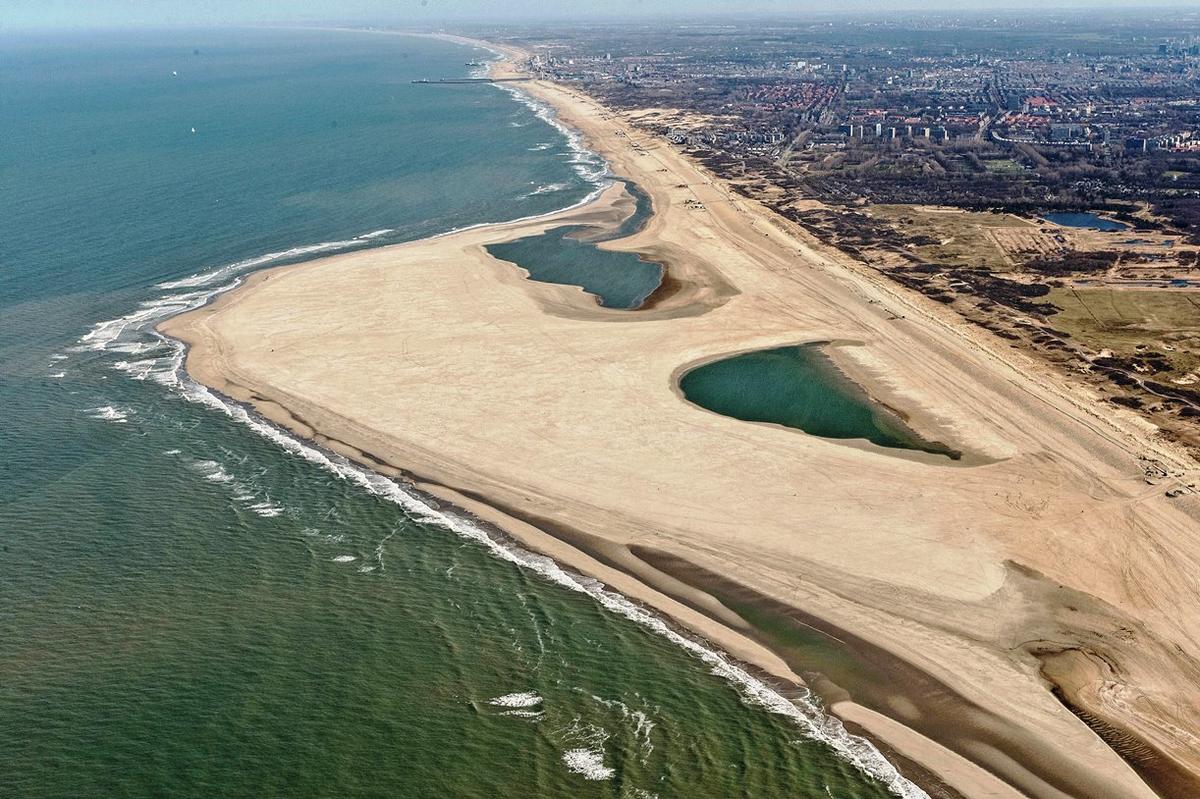 Figure 4: Sand motor (Photo: Joop van Houdt/ Rijkswaterstaat, beeldbank.rws.nl).
In Lower Saxony foreland management plans are further developed and put into practice aiming at harmonizing the demands of land use, nature conservation and coastal defence. The sustainment of salt marshes as a legal element of the system is an important factor for all sectors.
Measures to rewet and lower the ground surface took place in some salt marshes that had a conservation status of ‘lesser than favourable’ according to the EU Habitats Directive. These measures enhanced the ecological quality of these areas, and, at the same time, provided suitable building material for dike strengthening.
Lower Saxony is partner in the EU Interreg “Building with Nature” project. A special focus is put on the further improvement of shore und foreshore nourishments for structurally eroding coastal stretches on the East Frisian Islands as a sustainable solution for coastal risk management.
In Schleswig-Holstein, a sediment management concept for Coastal Risk Management will be established as one main outcome of the integrated adaptation strategy (Ministerium für Energiewende, Landwirtschaft, Umwelt und ländliche Räume des Landes Schleswig-Holstein, 2015). The strategy was established by coastal risk management and nature conservation administrations together with relevant NGOs such as WWF. As precondition for future coastal risk management measures it is stipulated that measures like dike-strengthening (that needs a lot of sand and clay) may not lead to extra sediment deficits in the Wadden Sea. One example may be the re-use of dredged material from harbours and shipping lanes. As partner in the “Building with Nature” project, Schleswig-Holstein investigates how the sand nourishments on Sylt may optimally contribute to balancing the expected sea level rise induced sediment deficits in the Wadden Sea.
As prescribed in the Master Plan Coastal Risk Management (Ministerium für Energiewende, Landwirtschaft, Umwelt und ländliche Räume des Landes Schleswig-Holstein, 2013), in the planning phases for dike-strengthening campaigns, the responsible administration investigates the most ecologically friendly alternatives and implements these as far as possible. For example by minimizing the built-over areas or implementing the “wide-green dike” concept (see above). Another example is a small polder near Husum (Dockoog) where in advance of a dike strengthening campaign, multiple stakeholders have been engaged in a planning dialogue about the possible alignment of the dike (see www.wwf.de/watt/pikkiwatt).
In Denmark, sediment management concepts for the Danish Wadden Sea coasts are only needed at the peninsula of Skallingen. Along the coasts of Rømø, Mandø and Fanø sediment accretion occurs and the coastlines are stable.
In the “Building with Nature” project, Denmark will continue with the analysis and modelling of sediment transport pattern with the objective of establishing a sediment budget for the Danish part of the Wadden Sea.
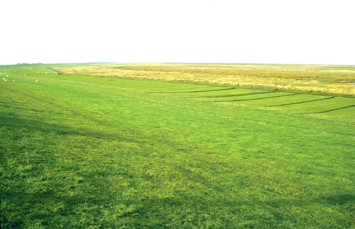 Figure 5: Wide green-dike concept in Schleswig-Holstein (Photo: Jacobus Hofstede).
Spatial planning and coastal risk management
Coastal risk management and spatial planning in the coastal zone are strongly related to each other and are interdependent. Good cooperation between the responsible authorities (between sectors and also between national, regional and local levels) is essential to successfully face the challenges posed by climate change.
The working group on Coastal Protection and Sea Level Rise (CPSL, 2005) recommended in 2005 that coastal zone spatial plans should be established on the basis of integrated coastal zone management and that coastal defence and sea level rise should be duly considered. In 2010, CPSL (CPSL, 2010) stated that "Coastal buffer zones and coastal flood hazard zones should be implemented in spatial plans, including the application of regulatory measures within these zones".
Spatial planners are generally aware that taking into account flood risks is a necessity for sustainable development of the coastal zone. The challenge is to provide good information on flood risk in the spatial planning process. Also coastal risk managers generally realize that spatial planning is crucial to ensure that sufficient space is reserved for (future) measures and that sustainable development can help reducing damage due to floods. Spatial plans do not yet always address these issues.
The EU Floods Directive prescribes that member states have defined potential significant flood risk areas and that flood risk management plans be established. Flood hazards maps (see Figure 6A) must delineate risk areas that can be potentially flooded with low, medium and high probability. This information helps spatial planners to take flood risk into consideration in spatial plans.
In the Netherlands the Delta Programme “Nieuwbouw en herstructurering” has investigated how spatial planning can contribute to reduce future flood risks. One of the conclusions is that good cooperation and information exchange in an early phase of initiatives helps to find optimal solutions. In the Delta decision "Spatial adaptation" (Delta Programme, 2015) the national government, provinces, municipalities and water boards agreed that spatial planning must be water robust and climate proof by the year 2050. Possible measures are flood proof building (see Figure 6B), spatial reservation and buffer zones. Further a knowledge platform Spatial Adaptation was developed (www.ruimtelijkeadaptatie.nl). Here information can be exchanged and tools are made available to help governments in developing strategies and taking appropriate measures.
Flood risk maps and flood risk management plans have been developed according to the demands of the EU Floods Directive. Flood risk maps are found on the website www.risicokaart.nl and will be updated in the period between 2016 and 2021. Flood risk management plans are published as an appendix of the second National Water Plan (Dutch Ministry of Infrastructure and the Environment, 2015) (see also www.helpdeskwater.nl).
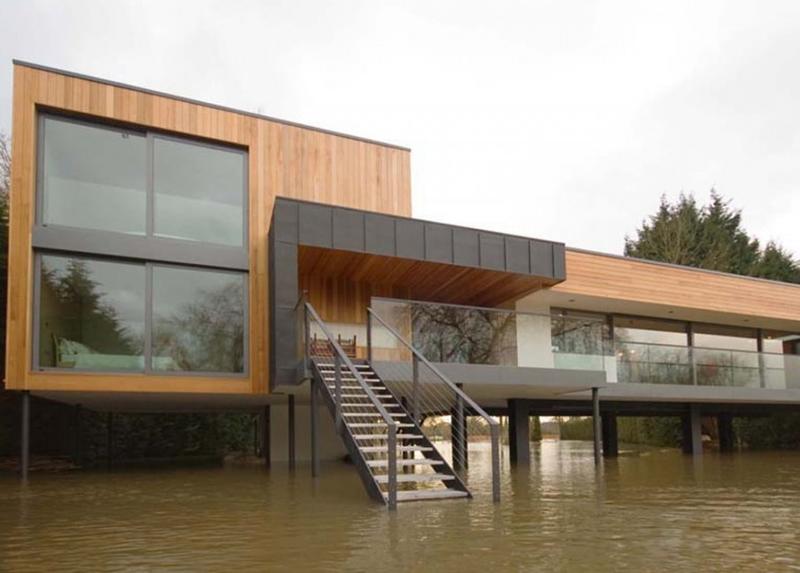 Figure 6. Left (A): Flood risk mapping (Image: 2013 LGLN); Right (B): flood resistant building (Photo:John Pardey Architects).
In Lower-Saxony the State Spatial Plan (Landes-Raumordnungsprogramm) (Niedersächsisches Ministerium für Ernährung, Landwirtschaft und Verbraucherschutz, 2012), which is currently being updated, integrates demands of coastal protection under the chapter “Integrated development of the coast, the islands and the marine areas”. Areas needed for future coastal protection measures (including excavation sites for sand and clay) shall be secured. Areas for extraction of clay needed for future coastal protection measures shall be designated primarily in the hinterland through regional spatial plans. In order to provide for climate change adaption, opportunities for risk reduction in flood-prone coastal areas have to be considered in plans and measures. Areas with extra high risk potential are to be designated as areas of reservation. Special regulations are also integrated in the Lower Saxony Dike Law.
According to the EU Floods Directive, which was implemented by the national Water Management act, flood hazard maps and flood risk maps have been prepared for the river basin districts river Ems, river Weser and river Elbe in Niedersachsen. Also flood risk management plans were prepared by the end of 2015 (see www.nlwkn.niedersachsen.de). The maps and plans for the river basins also cover the coastal area.
In Schleswig-Holstein, the State Development Plan (Landes-Raumordnungsprogramm) is being updated. In the draft, areas of preference for coastal risk management and coastal areas of reservation for climate change adaptation are included. In the areas of reservation, measures that are in conflict with climate change adaptation are prohibited. This includes the reservation of sufficient space for future dike-strengthening campaigns and of buffer zones for natural coastal retreat. In the areas of preference for coastal risk management, future activities and new uses that increase the risk of flooding should be avoided. If unavoidable, they should be well adapted to the risks (e.g., buildings on dwelling mounds, flood-proof building).
Flood risk maps and flood risk management plans have been made according to the demands of the EU Floods Directive. Flood hazard and risk maps for different scenarios are found on the website www.hochwasserkarten.schleswig-holstein.de. Flood risk management plans have been developed and are published on www.hwrl.schleswig-holstein.de.
In Denmark ten flood prone areas have been designated under the EU Floods Directive. These areas cover 22 municipalities. The responsible municipalities have prepared flood risk management plans based on flood hazard and flood risk maps, that were prepared by the Danish Coastal Authority (see miljoegis.mim.dk).The flood risk management plans also refer to other planning levels, in particular the municipal climate adaptation plans, but also the overall municipal plans, wastewater plans and contingency plans, etc. Municipalities must also coordinate the content of risk management plans with water plans of the Water Framework Directive for the current river basin district. Therefore, risk management plans must take into account protection and improvement of water bodies, while the hazard and risk of floods must be managed. A summary of all municipal flood risk management plans can be found at kysterne.kyst.dk.
3. Summary
Coastal risk management has a long tradition in the Wadden Sea Area. It will remain ever-important as the sea level rises and people continue to work and live in flood prone areas around the Wadden Sea. The challenge is to fully integrate coastal risk management in managing the Wadden Sea World Heritage site. It is important that the unique values of the landscape and the ecological values are duly considered when necessary measures are planned, designed and executed. This requires close cooperation between the responsible administration(s) for coastal flood defence and coastal protection and the administrations responsible for nature conservation, spatial planning and the Wadden Sea World Heritage site. Non-governmental organizations that manage sites in the coastal zone are also an important partner in coastal risk management. Finally, knowledge of and experiences with coastal risk management around the Wadden Sea should be shared on academic, policy and practical levels. In this way we will not only be able to ensure safety and to enable working and living in and around the Wadden Sea, but also succeed to preserve and improve its outstanding universal values.
About the authorsRobert Zijlstra1, Jacobus L.A. Hofstede2, Thorsten Piontkowitz3, Frank Thorenz4 1 Ministry of Infrastructure and Water Management (Rijkswaterstaat), Zuidersingel 3 , 8911 AV Leeuwarden, Netherlands 2 Schleswig-Holstein Ministry for Energy Transition, Agriculture, Environment, Nature and Digitalization (MELUND), Düsternbrooker Weg 104, 24105 Kiel, Germany 3 Danish Coastal Authority (Kystdirektoratet), Højbovej 1, 7620 Lemvig, Denmark 4 Lower Saxon State Department for Waterway, Coastal and Nature Conservation (NLWKN), Am Sportplatz 23, 26506 Norden, Germany |
References
CPSL (2001) Final Report of the Trilateral Working Group on Coastal Protection and Sea Level Rise. Wadden Sea Ecosystem No. 13. Common Wadden Sea Secretariat, Wilhelmshaven, Germany.
CPSL (2005) Coastal Protection and Sea Level Rise - Solutions for sustainable coastal protection in the Wadden Sea region. Wadden Sea Ecosystem No. 21. Common Wadden Sea Secretariat, Trilateral Working Group on Coastal Protection and Sea Level Rise, Wilhelmshaven, Germany.
CPSL (2010) CPSL Third Report. The role of spatial planning and sediment in coastal risk management. Wadden Sea Ecosystem No. 28. Common Wadden Sea Secretariat, Trilateral Working Group on Coastal Protection and Sea Level Rise, Wilhelmshaven, Germany.
Delta Programme (2015) Delta Programme 2015, Working on the delta. The decisions to keep the Netherlands safe and liveable. See: http://english.deltacommissaris.nl/delta-programme/documents/publication...
Delta Programme (2015) Voorkeurstrategie Deltaprogramma Waddengebied, veilig leven en werken in een natuurlijk waddengebied (English: preferential strategy, safe living and working in a natural Wadden Sea area), background report D7, Delta Programme 2015. See: http://www.deltacommissaris.nl/deltaprogramma/documenten/publicaties/201...
Dutch Ministry of Infrastructure and the Environment (2009) National Water Plan 2009 - 2015. See: https://www.rijksoverheid.nl/documenten/rapporten/2009/12/01/nationaal-w...
Dutch Ministry of Infrastructure and the Environment (2015) National Water Plan 2016 - 2021 See: https://www.rijksoverheid.nl/documenten/beleidsnota-s/2015/12/14/nationa...
Hofstede, JLA & Stock, M. (2016) Climate change adaptation in the Schleswig-Holstein sector of the Wadden Sea: an integrated State Governmental strategy. Journal of Coastal Conservation: Planning and Management. See: http://link.springer.com/article/10.1007/s11852-016-0433-0)
Ministerium für Energiewende, Landwirtschaft, Umwelt und ländliche Räume des Landes Schleswig-Holstein (2015) Strategie für das Wattenmeer 2100. See: www.schleswig-holstein.de/DE/Fachinhalte/N/nationalpark_wattenmeer/bericht_strategie_wattenmeer2100.html)
Ministerium für Energiewende, Landwirtschaft, Umwelt und ländliche Räume des Landes Schleswig-Holstein (2013) Generalplan Küstenschutz des Landes Schleswig-Holstein – Fortschreibung 2012. Kiel, 100 pp. See: www.kuestenschutz.schleswig-holstein.de)
Ministerpräsidentin des Landes Schleswig-Holstein (Hrsg.) (1998) Landesraumordnungsplan (eng: State Development Plan) Schleswig-Holstein 1998. Kiel, 78 pp. See:
Niedersächsisches Ministerium für Ernährung, Landwirtschaft und Verbraucherschutz (2012) Landes-Raumordnungsprogramm Niedersachsen, http://www.ml.niedersachsen.de/portal/live.php?navigation_id=28071&article_id=90404&_psmand=7
Niedersächsisches Ministerium für Umwelt, Energie und Klimaschutz (2013) Klimapolitische Umsetzungsstrategie Niedersachsen. See: http://www.umwelt.niedersachsen.de/klimaschutz/aktuelles/klimapolitische-umsetzungsstrategie-niedersachsen-113102.html
Niedersächsische Landesbetrieb für Wasserwirtschaft, Küsten- und Naturschutz (NLWKN) (2007) Generalplan Küstenschutz (Eng: Master plan Coastal risk Management), Norden. See http://www.nlwkn.niedersachsen.de/download/22925/Generalplan_Kuestenschutz.pdf
Niedersächsische Landesbetrieb für Wasserwirtschaft, Küsten- und Naturschutz (NLWKN) (2010) Generalplan Küstenschutz Inseln (Eng: Master Plan Coastal Risk Management East Frisian Islands), Norden. See: http://www.nlwkn.niedersachsen.de/download/59866/Generalplan_Kuestenschutz_Inseln.pdf
Kystdirektoratet (2011) Digeoversigt, Syd- og Sønderjylland (eng. The Dige Overview for South Jutland). Danish Coastal Authority, Lemvig. 132 sider, http://omkystdirektoratet.kyst.dk/rapporter-om-digerne-i-vadehavet.html.
Tønder Declaration (2014) Annex 6, Trilateral Climate Adaptation Strategy. Trilateral Working Group on Climate (TG-C), Wilhelmshaven, Germany. See: https://www.waddensea-worldheritage.org/resources/climate-change-adaptat...
World Wildlife Fund (2015) Klimaanpassung an weichen küsten, Fallbeispiele aus Europa und den USA für das schleswig-holsteinische Wattenmeer (English: Climate Adaptation along Soft Coasts. Examples from Europe and the U.S. for the Schleswig-Holstein Wadden Sea), World Wildlife Fund Deutschland, Jannes Fröhlich, Dr. Hans-Ulrich Rösner, 78 pp. See: http://www.wwf.de/fileadmin/fm-wwf/Publikationen-PDF/WWF-Studie-Klimaanpassung-an-weichen-Kuesten.pdf
Quante M, Colijn F (eds) (2016) North Sea Region Climate Change Assessment. Regional Climate Studies, Springer Verlag, Cham, Heidelberg, New York, Dordrecht, London. See: http://noscca.hzg.de/
This report should be cited as: Zijlstra R., Hofstede J.L.A., Piontkowitz T. & Thorenz F. (2017) Coastal Risk Management. In: Wadden Sea Quality Status Report 2017. Eds.: Kloepper S. et al., Common Wadden Sea Secretariat, Wilhelmshaven, Germany. Last updated 21.12.2017. Downloaded DD.MM.YYYY. qsr.waddensea-worldheritage.org/reports/coastal-risk-management
